About This Product
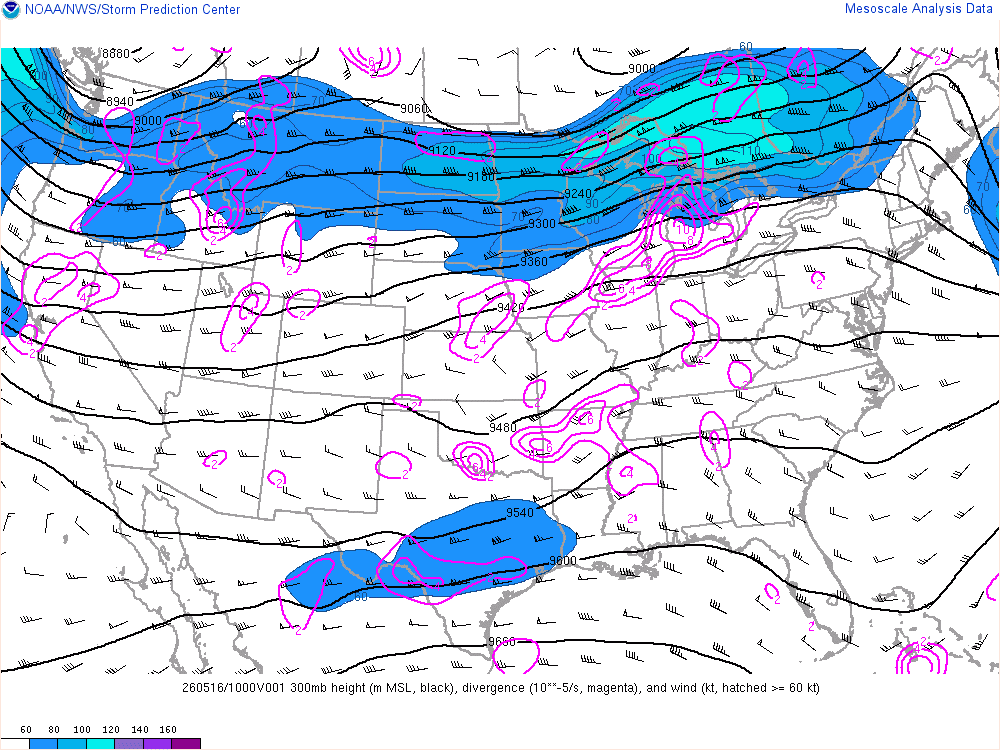
The 300 millibar (mb) map plots a variety of information collected by weather balloons and represents atmospheric conditions at an altitude of approximately 9300 meters (30,000 feet). The map displays:
- The height of the 300 mb level (meters) in black contours at 60-meter intervals.
- Divergence (per second) in magenta contours at intervals. Upper-level divergence is typically associated with upward motion.
- Wind (knots) — Wind barbs are displayed in a grid. The wind barb is an "arrow" that depicts the wind speed and direction. The "feathers" of the arrow indicate the wind speed while the blank end of the arrow indicates the direction the wind is blowing toward. In addition, regions with wind speeds above 60 knots are shown as blue contours at 10-knot intervals and shaded blue, or shaded purple if above 120 knots.
This map is updated hourly. For more details, visit the NWS Storm Prediction Center's Mesoscale Analysis website.